By Katherine Gombay
They’ve studied some of the world’s most congested cities. Now researchers in McGill’s Faculty of Engineering are using that experience to make traffic of all kinds move more smoothly through Montreal’s streets.
Until there’s teleportation, we’ll have to deal with traffic. City planners around the world are increasingly under pressure to set in place transportation policies that will directly reduce greenhouse gas emissions. Now McGill researchers in the Department of Civil Engineering and the School of Urban Planning, both part of the Faculty of Engineering, are using that wealth of experience to bring sustainable transportation planning and engineering to Montreal’s streets.
Effective transportation planning begins by understanding the people actually being transported. City planners would certainly have an easier time if they could simply force people to use certain routes and certain kinds of transportation — but, of course, that’s not feasible. Instead, in order to make long-term decisions about transportation and traffic, they first need to gather information about the elements that play into an individual’s choice about what kind of transportation to use. And this is where Naveen Eluru can help. A recent addition to the Department of Civil Engineering, the assistant professor became interested in transportation modelling because it allows him to use his love of math to solve real human problems.
Eluru collects data on individual travel information (such as where people are going and how they’re getting there). By collecting such detailed data from just five per cent of the population within an urban region, he is then able to use complex models to make predictions about travel choices for the population as a whole. This information can then be manipulated to help city planners understand how individual travel choices might change if policies were set in place to encourage certain kinds of transportation choices and discourage others.
“We can look at what will happen if there is emissions taxing, for instance, where you charge a certain price for every kilometre people travel in their cars to see whether that will work in reducing the number of kilometres people drive,” Eluru explains. “Or what if we improve public transportation so that people only have to walk half a kilometre to the bus and we have more frequent service — will this increase the number of people using public transportation? If you want to understand how much money to invest in transportation you need to look at policies where increasing transportation affects actual ridership numbers and reduces automobile usage.”
Ahmed El-Geneidy, an assistant professor in the School of Urban Planning, has had the chance to work on these issues directly while helping to reshape one of Montreal’s busiest bus routes. Working with the Société de Transport de Montréal (STM), El-Geneidy and his students used GPS systems and passenger counters along with rider surveys to redesign the No. 67/467 route which transports nearly 40,000 passengers each day. Both buses follow the same route, but whereas the regular bus (No. 67) has 40 stops that are spaced about 400 metres apart, there are only 15 stops on the express bus route (No. 467), and the distances between them stretch to over a kilometre in some cases. “We estimate time savings in the order of 10 per cent,” says Paul Tétreault, a graduate student who worked with El-Geneidy on redesigning the route. “The methodology we developed could be used to put in place other limited-stop routes on heavily used bus lines and improve transit service.” Thanks to the reduced number of stops, the express bus also has lower carbon dioxide emissions — a change that helps all of us breathe a little easier.
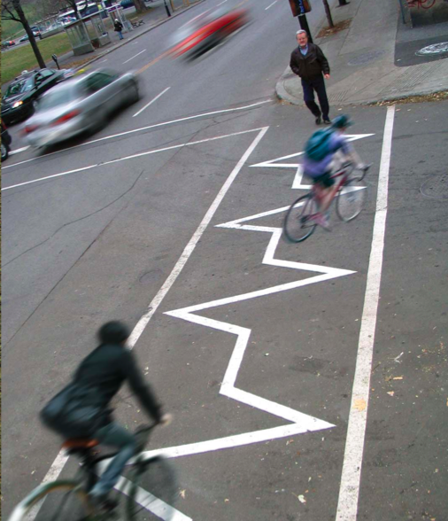
In addition to studying Montreal’s mass transit, El- Geneidy is also interested in the city’s two-wheeled commuters. Bicycling is no small thing in Montreal, which was recently named the eighth-most bike-friendly city in the world by Copenhagenize, a Danish urbanplanning group that specializes in cycling culture. (The top two cities, not surprisingly, were Amsterdam and Copenhagen. Montreal was the only North American city in the top ten.) Montreal has a bike-sharing program, named Bixi, that now boasts 40,000 members, and more than 500 kilometres of urban bike paths that the city plans to double by 2020. But El-Geneidy wants to know exactly how all these cyclists are using the city — so he talked to almost 3,000 of them.
El-Geneidy and co-author Jacob Larsen, a PhD student, used an extensive survey to create a detailed analysis of how Montreal riders use the city’s cycling facilities, be they on-street or off-street paths. The researchers gathered detailed origin-destination information, as well as data about specific routes used by cyclists, to understand the relationship between travel patterns and the availability of cycling facilities. Among their conclusions, the researchers found that recreational cyclists are more likely to use physically separated paths than their hardcore brethren — yet it’s the latter who are riding much greater distances in the city. With the city of Montreal wanting to double its existing cycling facilities by 2020, the study warns of a tough choice: Attract more occasional cyclists by building expensive separate paths, or cater to the higher-mileage needs of the city’s serious cycle-commuters by building more on-street bike lanes?
Luis Miranda-Moreno may not have the answer to that particular question, but he’s certain of one thing: Cycle tracks greatly improve cyclist safety — and safety is very much on Montrealers’ minds after two cyclists were killed by cars within a 48-hour period last summer. Miranda- Moreno is a professor in the Department of Civil Engineering at McGill. He has been working with Montreal city officials, as well as with representatives from Quebec’s Département de la santé publique, to try to make Montreal safer for cyclists.
Miranda-Moreno and his students have created a mobile safety lab to monitor non-motorized transportation. Using a range of sensors and a GPS traffic-tracking system, they collect data about the way that pedestrians and cyclists are currently using the city streets. What they’ve discovered is that bicycle paths are overflowing, and that, despite the large numbers of cyclists on many streets, traffic lights are still mainly synchronized to car speeds. He thinks that should change.
Miranda-Moreno suggests that on streets where there is more bike traffic than car traffic, lights should be adjusted because cyclists are more likely to stop at red lights when green lights are lit for adequate stretches of time. “Synchronization is critical,” he says. “In Europe, they’re trying to accommodate pedestrians and cyclists, to reduce traffic delays not only for vehicles, but for everybody.”
Of course, traffic light timing isn’t only of interest to cyclists. In order to understand how changes in the timing of lights might affect traffic flow, Montreal city planners have called on the expertise of Marianne Hatzopoulou, another recent addition to McGill’s Department of Civil Engineering. Using a tool that looks a bit like a 3D Etcha- Sketch in action, with lines and icons of different colours moving across the computer screen, Hatzopoulou and her students are able to create very complex traffic simulations.
Using satellite imagery, the team builds a grid of the existing streets in a borough. They then add a second layer to the grid, showing all the intersections, with details about each traffic light, right down to how much time each light is green, amber and red. The third layer, which is based on hard data such as traffic counts, adds the pedestrians, the cyclists and the cars to the model. “We’re simulating the entire Montreal Plateau neighbourhood and you can see every single car stopping at intersections, then moving and turning,” says Hatzopoulou.
Using the grid, Hatzopoulou can then simulate how traffic flow will be affected if a stop sign is added in one place, a bike lane is added somewhere else, or if the cycle times of certain traffic lights are changed. On the screen, the multicoloured lines and icons representing streets, cars, pedestrians and bicycles re-etch themselves as the researchers make changes to the data. “It’s the work of a lifetime building this kind of tool,” explains Hatzopoulou. “We keep adding to it and making it more realistic.” But this isn’t just about helping people get from Point A to Point B in a more timely fashion. Traffic flow has a direct effect on the quality of our air. “One significant variable in air pollution is the way that you’re driving your car,” says Hatzopoulou. “Idling, stop-and-go driving and aggressive driving all result in higher emissions of air pollutants. We will be looking at both the traffic and the generation of car emissions to see how we can optimize the system and reduce emissions. The Plateau is a good case study because these are dense neighbourhoods with lots of people living and moving around on the streets.” But it’s this very density of housing, businesses and population that is partly responsible for the problems with the urban air quality. “Because you have tall buildings on both sides of a street, you limit the dilution of air pollution caused by traffic,” says Hatzopoulou. She is also quick to point out that this means, ironically, that the people who are helping to reduce air pollution — pedestrians and cyclists — are also the ones sucking most of it into their lungs. So Hatzopoulou and her students are also doing some monitoring of pollution levels around the city in order to characterize the air quality at street level.
Hatzopoulou and her team will continue to add to the model, and she hopes that other Montreal boroughs may eventually want to use it to help them make changes to their respective traffic patterns. But she cautions that the model is not about predicting the future. Instead it’s about testing the effects of different traffic scenarios. “The model is not going to tell the policy-maker what to do. It’s just another voice around the table,” she says. But it’s a voice that Montreal Plateau policy-makers believe will help reduce traffic problems and air pollution, and they’re listening hard to what it has to say.
This research receives funding from the Natural Sciences and Engineering Research Council of Canada and the Canada Foundation for Innovation.