By Meaghan Thurston
By mapping biodiversity loss in rural regions near Montreal, McGill researchers are helping municipal land management planners prevent further disruptions to the ecosystems of Montreal’s green belt.
A bird’s-eye view of Quebec’s Montérégie region reveals a hodgepodge of woodlands cleaved by roads, farmland and residential hot spots. These “green islands” which dot the region are one of the richest providers of what researchers call “ecosystem services” – such things as maple and fruit production, habitat for pollination by wild bees, carbon storage and space for a variety of recreation activities.
But the fact the green islands are sparse and unconnected is cause for concern, and can present a serious challenge to the biodiversity of the region, which has not always looked as it does now; the number and nature of those “green islands” has fluctuated through time as the result of such human activities as agriculture and urban growth.
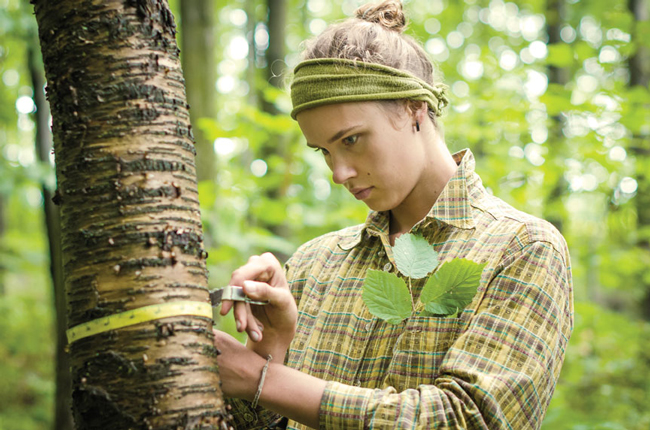
As a McGill graduate student, Martine Larouche recently conducted historical studies of the region’s landscape and found that gradual deforestation due to the expansion of agricultural lands over 140 years has resulted in a loss of 36 per cent of the forests, and that 67 per cent of the forest patches have become isolated over time. Their isolation results in fragmented habitats – unconnected waterways and isolated woodlands – for the species that live there, threatening their survival.
The Montérégie is now the most populated region in Quebec outside of Montreal; it includes increasingly dense cities and towns on the St. Lawrence River’s south shore, just across from Montreal, as well as smaller rural towns and agricultural lands stretching to the U.S. border. New pressures are mounting for municipalities to support road construction and residential development, further threatening the biodiversity and the ecosystem services that urban dwellers covet. Surprisingly little is known, however, about managing habitats for the many services ecosystems provide.
Larouche’s studies are part of the Montérégie Connection research initiative, led by Elena Bennett, of the McGill School of Environment and the Department of Natural Resource Sciences; Martin Lechowicz and Andrew Gonzalez, of McGill’s Department of Biology; and Jeanine Rhemtulla, formerly of McGill’s Department of Geography (now at the University of British Columbia). These researchers have spent the past five years researching the linkages between ecosystem services, biodiversity, and land use. “Connectivity” is the key word that binds.
“If we can manage our mosaic of habitats and forest to ensure connectivity, we not only reduce the rate of biodiversity loss, but we also gain the benefits from the point of view of the services we get [for example, crop production, pest regulation, decomposition],” says Gonzalez.
Gonzalez develops mathematical models to explain how a landscape works, and the role biodiversity plays in sustaining eco-services. While he maintains there is no single perfect model for managing a landscape, the importance of incorporating a variety of forest fragment types across agricultural landscapes is becoming clear. “Connectivity, for me, is the fundamental goal of this project – to demonstrate its importance in the real world, not just in a mathematical model.”
In a fragmented landscape, species will encounter very real problems moving over land and water, an issue aggravated by fluctuating climates. “Under climate change, species are moving up from the south, and down from the north. A bird can fly over the city – if it can avoid the skyscrapers – but if you are a frog you need pathways,” says Lechowicz.
When forest links are made, not only is the biodiversity of an area conserved, but there is great potential to enhance the multifunctional use of agricultural landscapes. In one of the first empirical studies of the effects of forest fragments on the simultaneous provision of multiple ecosystem services, Matthew Mitchell, a recent McGill doctoral graduate, with Bennett and Gonzalez, observed that crop fields adjacent to forest edges can benefit from the supply of insect predators (like ladybugs) that control aphid pests known to reduce crop yield.
In another study by Kyle Martins, whose MSc was co-supervised by Gonzalez and Lechowicz, it was demonstrated that by preserving meadow and forest patches adjacent to orchards, producers could rely on wild bees for pollination. As domestic bee populations continue to decline in Quebec and Ontario, this option for managing the landscape to maintain the connectivity of different ecosystems takes on new significance for agricultural producers.
Connecting with the community
Supported by Lechowicz’s longstanding ties in the region (from 1995 to 2011 he served as director of McGill’s Gault Nature Reserve, a private estate donated to McGill in 1958 with the stipulation its forested landscape be preserved), the McGill researchers, together with municipal leaders and other stakeholders, are developing scenarios about possible futures for the region, designed to promote further dialogue on sustainability in the Montérégie [see footer].
In October 2014, Bennett and her team met with a municipal and provincial advisory board to present scenarios or “stories” that have emerged from concerns stakeholders have about the future of the region and its ecosystem services. These “ecological trajectories” provide community members with concrete examples of the long-term effects of land change and development.
Kees Vanderheyden, director of the Mont Saint-Hilaire Nature Centre, one of the project’s many partners, sees the stories as tools to inspire discussion about pressing questions, such as: What will be the long-term impact on the ecosystem if we pursue the development of a highway or a commuter bridge in a particular municipality? “It’s tough to explain when things are far away in time,” he says. “We have to bring these ecological issues to light, and make it personal.”
Bennett says the engagement of the partners with the stories and their implications is “heartwarming.” “[At this meeting,] I looked around the room and people were literally sitting on the edge of their seats. They were asking themselves and each other – what do we want for the future of our region and what message do we want to send about how to achieve that future?”
There is a good reason for the municipal leaders to consider seriously what actions to take. Recent provincial legislation calls for all municipalities to update their natural-environment and landscape-management plans within the next five years.
Bernard Morel, the director of the Land-Use and Environmental Planning Department at the municipality of Mont-Saint-Hilaire, says the community is concerned about protecting the biodiversity of the region, including the woodlands. “The researchers have sensitized the community to the science behind the need to preserve and connect the woodlands,” he says. “The communities have been able to take this knowledge and modify their approach, allowing us to begin putting in place plans for our most-hoped-for scenario.”
The Montérégie Connection Project has been supported by funding from the Natural Sciences and Engineering Research Council, Ouranos and the Max Bell Foundation.
Choose your future: four different landscape-management stories
Based on their consultation with Montérégie municipal leaders and other stakeholders, McGill researchers have identified these four scenarios as potential future land uses in the region:
Peri-urban development: a significant population increase inspires the construction of four new residential neighbourhoods. A new bridge is built in the eastern part of Montreal in 2030, expanding residential growth in the northern towns of the Montérégie. Urban development demands further deforestation and diminished agricultural activity in certain regions. Agro-tourism is threatened.
Demand for energy: To mitigate rising energy costs, shale gas exploitation is undertaken, wind turbines are installed and options for hydroelectricity production are explored; forests are felled for wood in the northern sectors. To halt rising water levels, a partial canal is installed in the Richelieu River. Employment rises, as do taxes. Agricultural production decreases, and climate changes increase.
Whole-system crisis: Rising household debt drives housing prices down. An aging population puts a strain on services and limits employment opportunities. Single-family homes are converted into condos. The Asian long-horned beetle invades, decimating the maple population. Deforested land is converted for agriculture, or left fallow. Intensive farming is undertaken for export. Little investment in electric transport (trams) is made.
Green development: There is a political shift toward sustainable development. Renewable energies such as wind and solar power are prioritized, as are investments in bike pathways and green tramways. Employment is on the rise. Reforested farmland in the north provides maple products, recreation and mushroom crops. Seventeen per cent of the land is protected from development by 2035. What development is undertaken focuses on sharing resources.